


The ports of the Kingdom of Galicia, in an ancient French game of the 18th century
The ports of the Kingdom of Galicia, in an ancient French game of the 18th century
The Prince of Conti of the Kingdom of France commissioned in the 1940s of the 18th century Galus designer Lus Nicolas Delaistre de Poilly, a new project with the idea of the French people learning geography from all the world known through the game... as a current trivial. The game in which the croquis of the main ports, in this case of the waters of the Cantabrian and the Atlantic Galician, have notoriety; they make us think of it is the first historical document at international level as a game... and also in which different Spanish areas have special relevance, as in this case Galicia, through the Old Kingdom considered the oldest of those who existed or exist on our old continent.
This was true thanks to French game and card professional Jean Baptiste Mitoire... the first copy out of his hands, appears at the Birtish Museum in London, in a specific room. The great London piece has sets of Netherlands, Ireland, Italy, Spain, Portugal, Africa, America and Asia... The Hermeric Association has one of the most numerous pieces in its original cardsplay collection, in an excellent state... dedicated to the Old Kingdom of Galicia and apparently by the typography used in this work includes as an annex to it the Kingdom of Asturias:
The letters of the Kingdom of Galicia in a French geographical trivial of 1761
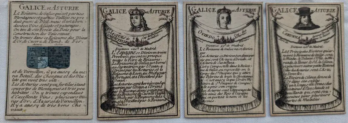
1.2 Letter from the old shield of the Kingdom of Galicia and explanation of the work (2 current letters)
3, Letter with a summary of the Kingdom of Galicia
4-6, Letters of Oviedo, La Coruña, Santiago
7, Map of the two colored kingdoms
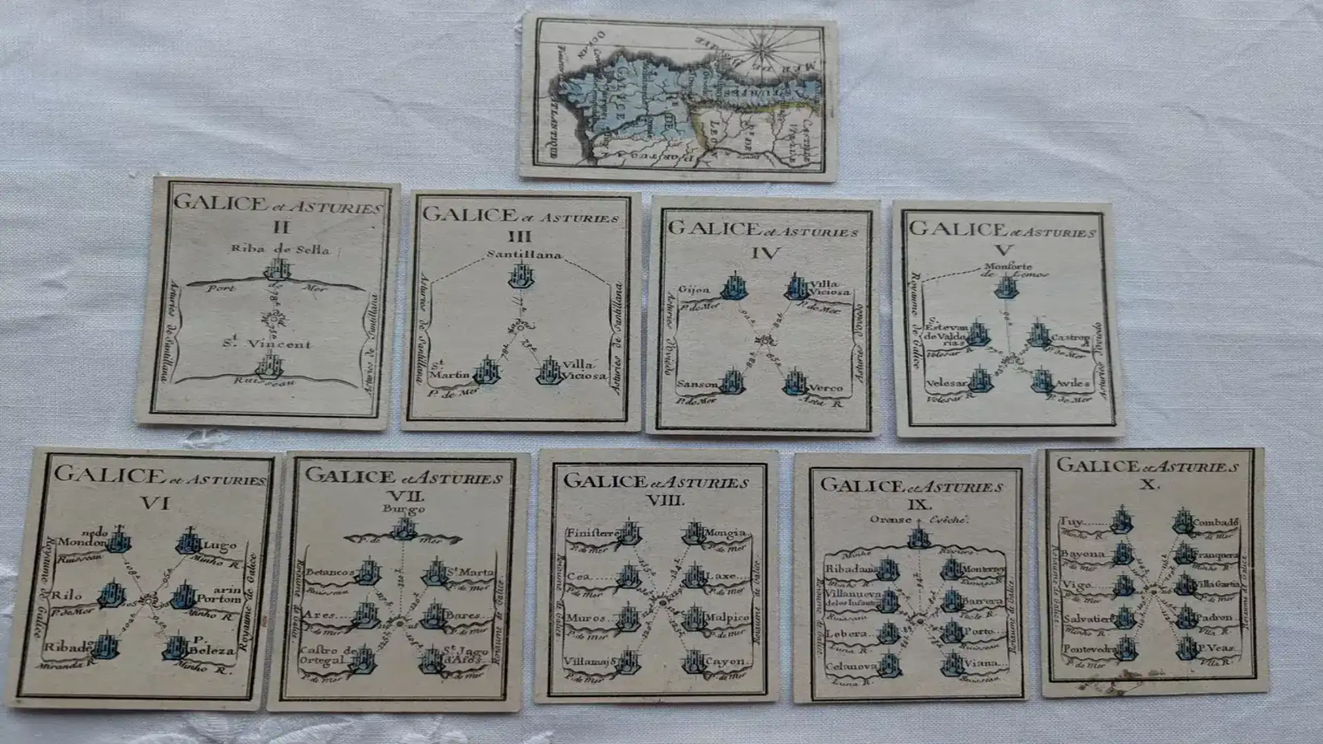
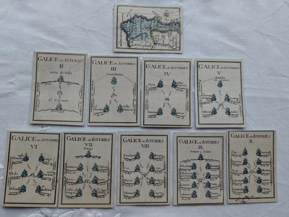
8-10, Croquis-Portulanos, from areas of Ribadesella, Santillana, Gijón,
11-16, Croquis-Portulanos, from areas of Castropol, Ribadeo, Betanzos, Finisterre, Orense, Vigo
© 2024 Nautica Digital Europe - www.nauticadigital.eu


