


The Guadalquivir was navigable in the Roman era until Córdoba
The Guadalquivir was navigable in the Roman era until Córdoba
Evolution of the Paleoeestuary of Guadalquivir and Guadalete from 6000 BC (Neolithic period) (personals.us.es)
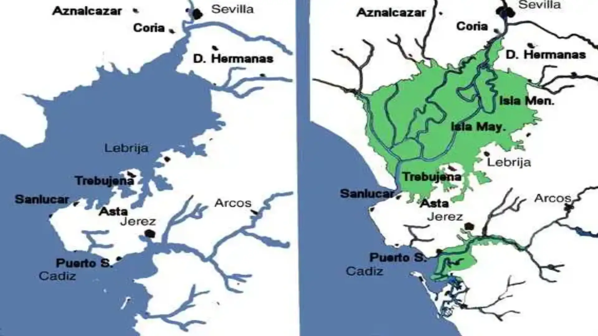
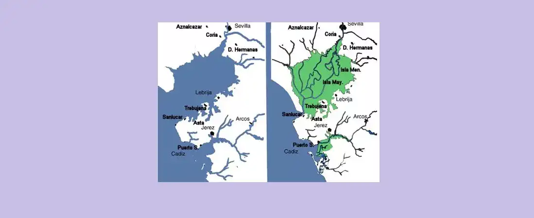
The role that the Guadalquivir has historically played has been so important that there have been many research carried out around the transformations suffered by the river line. These have pointed out for the surroundings of the region of La Ribera and Las Marismas del Guadalquivir, the existence of an extensive marine gulf at the mouth of the Guadalquivir, which is also the origin of the region of Marismeña. These data already in the grecolatine sources have been confirmed by geological analysis.
The marine engenade reached its largest extent towards the middle of the Holocene with the maximum transgressive flandriense. The limos and sediments that dragged the river along its channel were hanging it, and began to form around 2000 BC a delta that motivated the advance of the mouth and the filling of the Gulf's bucket. In the Tartesian era the mouth of the river was located just at the height of the Cerro de San Juan, at the point known as "Strait of Coria." The huge bay followed its process of hanging, and course above the mouths of the river began to form a flood plain to the height of Seville. In the period of Turdetana, the Gulf's filling continued to reduce its shores, and it led to the waters arriving at some points on the old coast line only with the plating. This is the landscape that describes the grecolatine sources when referring to the mats and the Lacus Ligustinus.
Until the end of the 4th century, the estuary of Guadalquivir occupied that great lagoon of marine influence, called the Tartesic Gulf... which came from the open ocean to something further below La Puebla del Río (Seville), evolved as a coastal arrow was closing its mouth and its funds were filled with sediments from the erosion of the Guadalquivir basin to a salty albufera (Facebook image)
The collation continued its course to complete the bucket and lead to the current landscape, with the marshes as a result of the river transformation. Historically, the Guadalquivir has been the main means of communication of the region. This is due not only to the ease it has offered for navigation during all times, but also to the fact that it is a way of contacts that, since Prehistory, has had an international reach. The river forms a structure that, with it as the main artery, serves as the basis for expansion to any cultural element from outside, as well as for the export of indigenous products, whether cultural, economic or any other kind.
But the Guadalquivir has had another role related to the world of the dead and the realization of rites linked to offerings of weapons and other personal beings to the waters, as they were carried out in many points of the European Atlantic facade in the Bronze Age. The river is the raison d'être of all the populations that settle next to its channel, to the point that the variations of it, with the abandonment of certain meandros, have been the cause of decline and even the disappearance of numerous cities.
The case of Coria is very significant in this regard, since its paleogeographical implementation at the entrance of the Guadalquivir valley until practically Roman times made the population the point of control of the river traffic. The sanctuary of the protohistoric period recently excavated in the Cerro de San Juan is the product of that casuistic. The same watchdog and sentinel role that accompanies the population has pointed to other local historical milestones such as the normal landing in 844, the role of Coria in the take of Seville or in the Japanese contingent that settled in the town in the Middle Ages, among others that could be noted.
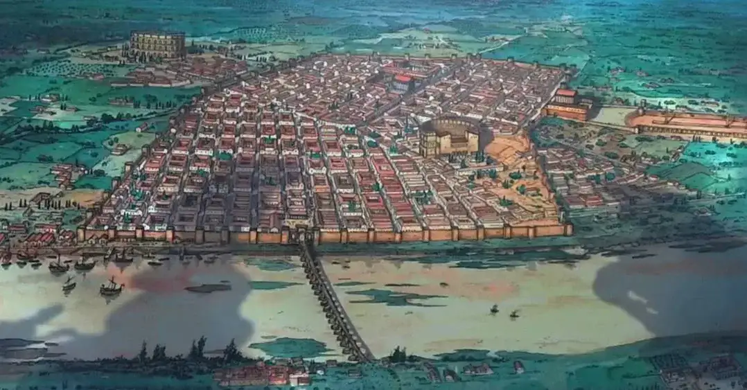
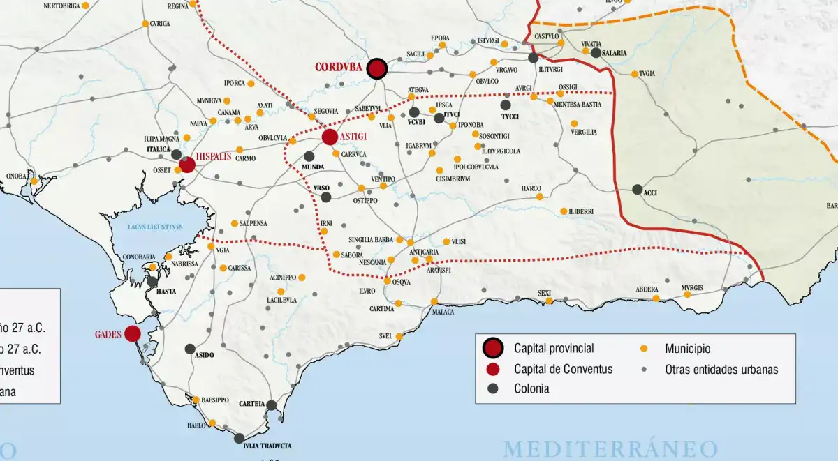
Córdoba had a river port at least during Roman and even Muslim times. Estrabón and Plinio el Viejo mention that the Betis River was navigable to Córdoba. Its location is not exactly known... authors point out that it could be in front of the Alcázar of the Christian Kings as they indicate remains that appeared after the construction of the San Rafael bridge
Archaeologically, the use of the river as a means of communication in the Chorian environment is based on the numerous material evidence that appears on the banks of the river and on the recurrent dragados that lower the river bed in the delimited section, as is the case with a set of double arpon arrow tips dated in the 7th or 6th century BC, or the carp-tongue sword published as coming from Bellavista, but others indicate its appearance in Chorian waters. These are related to the funeral rites of the protohistoric era in which weapons are thrown into the waters, following a custom of the Indo-European peoples of the European Atlantic facade. From the commercial level, the place known as the Isleta (Puebla del Río) comes a Roman specie.
Numerous elements appeared in the course of archaeological excavations or in fortuitous findings in the city centre of Coria, such as a Syriopalestino ceramic glass, as well as Egyptian perfume and scarlet vessels from the Cerro de San Juan show the use of the river as a way of import.
Note from the ND drafting
The text reflects a work of the Culture Council of the Junta de Andalucía
© 2024 Nautica Digital Europe - www.nauticadigital.eu


